

River Linking is project linking two or more rivers by creating a network of manually created canals, and providing land areas that otherwise does not have river water access and reducing the flow of water to sea using this means.
The population of India, which is around 1000 million at present and is expected to increase to 1500 to 1800 million in the year 2050. This huge population would require about 450 million tonnes of food grains. For meeting this requirement, it is necessary to increase irrigation potential to 160 million hectares for all crops by 2050. India’s maximum irrigation potential has been assessed to be about 140 million hectares. For attaining a potential of 160 million hectares, other strategies shall have to be evolved and one of the many strategies is River Interlinking Project.
Floods are a recurring feature in the subcontinent in general. Particularly Brahmaputra and Ganges rivers have flood issues that caused damages of approximate Rs. 52 corers in 1953, have gone up to Rs. 5,846 crores in 1998. The States of Assam, Bihar, West Bengal and Uttar Pradesh were badly affected along with numerous losses of life and inordinate human sufferings. On the other hand, large areas in the States of Rajisthan, Gujarat, Andhra Pradesh, Karnataka and Tamil Nadu face recurring droughts.
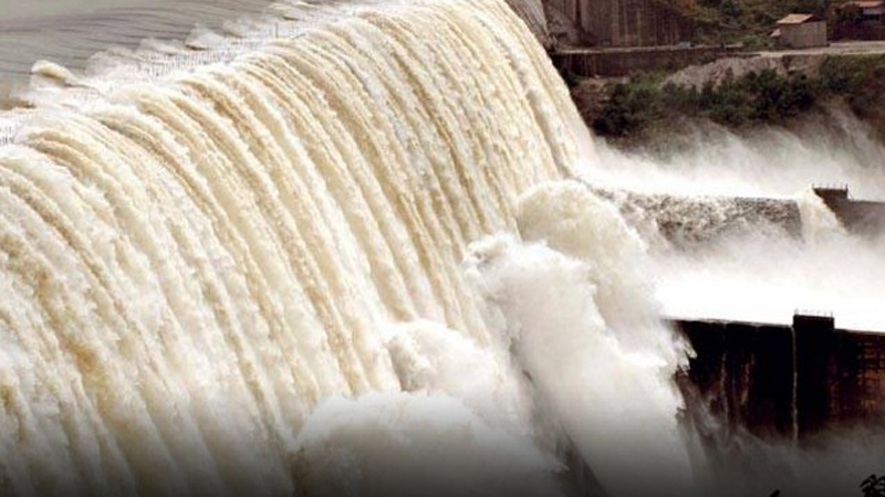
One of the most effective ways to solve the problems of food, flood and drought is transfer surplus water to deficit areas. Brahmaputra and Ganges particularly their northern tributaries, Mahanadi, Godavari and West Flowing Rivers originating from the Western Ghats are found to be surplus in water resources. India has started building storage reservoirs on these rivers and connects them to other parts of the country. The other benefits such as additional irrigation, domestic and industrial water supply, hydropower generation and navigational facilities were also achieved.

The Indian Rivers Inter-link is an engineering project that aims to link Indian rivers by a network of reservoirs and canals. The Inter-link project has been split into three parts: a northern Himalayan rivers inter-link component, a southern peninsular component and intrastate rivers linking component. The project is being managed by India’s National Water Development Agency (NWDA), under its Ministry of Water Resources. NWDA has studied and prepared reports on 14 inter-link projects for Himalayan component, 16 inter-link projects for peninsular component and 37 intrastate river linking projects.
In the 1970s, Dr. K.L. Rao, a dams designer and former irrigation minister proposed “National Water Grid”. In 1980, India’s Ministry of Water Resources came out with a report on “National Perspectives for Water Resources Development”. NWDA prepared various reports over 30 years but idea was not pursued proactively. The river inter-linking idea was revived in 1999, after a new political alliance formed the central government. The proposal was modified to intra-basin development.
The Indian Rivers Inter-link system consist of 541 kilo meters of interlink project is similar in scope and technical challenges as other major global river inter-link projects, such as Main–Danube Canal – completed in 1992, it also called the Europa Canal, it inter-links the Main river with Danube river, Illinois Waterway provide a shipping connection from the Great Lakes to the Gulf of Mexico via the Mississippi River, Tennessee–Tombigbee Waterway is a 377 kilometer man-made waterway that interlinks the Tennessee River to the Black Warrior-Tombigbee River in the United States, Gulf Intracoastal Waterway, completed in 1949, interlinks 8 rivers, and is located along the Gulf Coast of the United States.
The repercussions of this whole project appear to affect Bangladesh and Pakistan in various ways and triggering a terrible tide of hydropolitics that can lead all three countries to a full scale war. As a result of that a mutual destruction is inevitable phenomenon for this region.
The Ganges is disputed between India and Bangladesh. Downstream India controls the flow to Bangladesh with the Farakka Barrage, 10 kilo meters on the Indian side of the border. Until the late 1990s, India used the barrage to divert the river to Calcutta, to keep the city’s port from drying up during the dry season. This seriously affects Bangladeshi farmers and it badly threatened the Sundarban wetlands and mangrove forests at the river’s delta. The two countries have now signed an agreement to share the water more equally. Water quality and strategic threat is still keeping Bangladesh underdogs.
India started construction of Kishanganga Dam thus depriving Pakistan of its 33% water coming in Jhelum River. Pakistan is building the same type of dam called Neelum Jhelum Dam. After Indo Pak Treaty in 1960, Ravi and Sutlej River belong to India while Jhelum, Chenab and Indus belong to Pakistan. But still a growing suspicion and dissatisfaction exist on Pakistani side for sharing its water with India. Militaristically the growing hydropolitical stressful scenario is being viewed meticulously by world observers. There are serious strategic concerns that are keeping both nuclear countries at the threshold of tension and paranoia. A more direct hotline communication with top Brass and political governments is solution to keep the tension meltdown between two countries. Things should be more crystalized and open to keep situation under reasonable control.
As per UNO estimation, Pakistan’s population is at 188.9 million as of 2015[update]. Pakistan is the sixth most populated country in the world. Its growth rate is reported at 2.03%, which is the highest of the SAARC nations and gives an annual increase of 3.6 million. The population is projected to reach 210 to 213 million by 2020. In 2050 more mouth to be fed with meagre resources. Vast majority in Southern Pakistan lives and rely on the Indus River.

The structure of the Pakistani economy has changed from a mainly agricultural to a strong service base. Agriculture as of 2010[update] accounts for only 21.2% of the GDP. Even so, according to the United Nations Food and Agriculture Organization, Pakistan produced 21,591,400 metric tons of wheat in 2005. Majority of the population, directly or indirectly, is dependent on this sector. It accounts for half of employed labour force and is the largest source of foreign exchange earnings. A large portion of the country’s manufactured exports are dependent on raw materials such as cotton and hides that are part of the agriculture sector.
The Indus River provides key water resources for Pakistan’s economy . The ultimate source of the Indus is in Tibet; the river begins at the confluence of the Sengge Zangbo and Gar Tsangpo rivers that drain the Nganglong Kangri and Gangdise Shan (Gang Rinpoche, Mt. Kailas) mountain ranges. The Indus then flows northwest through Ladakh and Baltistan into Gilgit, just south of the Karakoram range. The Shyok, Shigar and Gilgit rivers carry glacial waters into the main river. It gradually bends to the south, coming out of the hills between Peshawar and Rawalpindi. The Indus passes through gigantic gorges near the Nanga Parbat massif. It flows swiftly across Hazara and is dammed at the Tarbela Reservoir. The Kabul River joins it near Attock. The remainder of its route to the sea is in the plains of the Punjab and Sindh. It is joined by the Panjnad at Mithankot. Passing by Jamshoro, it ends in a large delta to the east of Thatta.
The flow of the river is also determined by the seasons – it diminishes greatly in the winter, while flooding its banks in the monsoon months from July to September. The traditional source of the river is the Senge Khabab or “Lion’s Mouth”. There are several other tributaries nearby, which may possibly form a longer stream than Senge Khabab, but unlike the Senge Khabab, are all dependent on snowmelt. The Zanskar River, which flows into the Indus in Ladakh, has a greater volume of water than the Indus itself before that point.

There are 19 tributaries make river Indus as it seems in Punjab and Sindh and the their names are Beas River, Chenab River, Gar River, Gilgit River, Gomal River, Hunza River, Jhelum, River, Kabul River, Kunar River, Kurram River, Panjnad River, Ravi River, Shyok River, Soan River, Suru River, Sutlej River, Swat River, Zanskar River and Zhob River.
As a matter of fact European nations, USA, China and India has realized the future challenges of water problem as a threat to livelihood of their people and they developed very realistic long term plans to meet the need of their growing population decades ahead. Pakistan’s population will be in dire need of enough water to meet with requirement of food and economy. The only solution to this problem is to prepare a feasibility report for saving surplus water during monsoon and use for areas where we have drought or limited source of water so that in upcoming decades as a large size nation we could make both ends meet. Concrete canals, reservoirs, power generation, navigations, industrial and public water supply and other related facilities can be developed. We can Model India’s river interlinking project and raise the living standard of areas like Baluchistan, Cholistan and Thar deserts. China has already completed such big project successfully so their technical knowhow can be of great helpful for this plan.
If we will not set things in motion today in the year 2050 our future generations will pay the price with hunger, disease and other foreseeable miseries. Respect the water today. It is great luxury and gift of Allah Almighty. It must be appreciated with love and care.